Route 5 - Village Amble

Category: Easy
Distance: 4.2 km
Time: 2.0 hours

Downloads:

Village Amble (PDF) Village Amble (GPX) Village Amble (KML)

Click the PDF button to download a printable (PDF) copy of the entire route. Click the GPX button to download the route in a format suitable for smartphone apps and other navigation devices. Use KML to download the route in a format suitable for use with Google Earth.

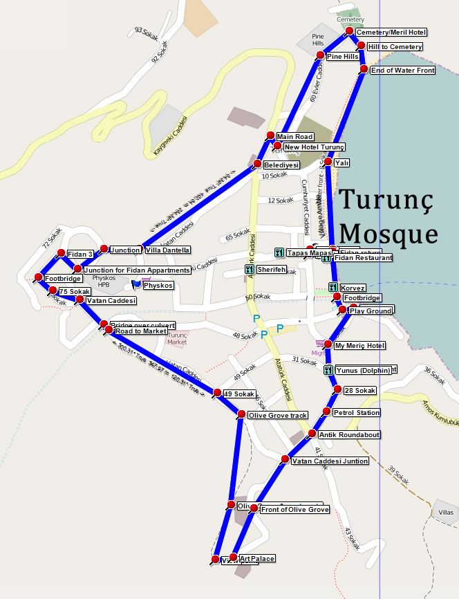
An easy, circular walk ideal for orientating yourself to the village and providing some great and unusual views of the village and bay. Mainly on paved roads there is one short section along a dirt track but this can be skipped if necessary.

Starting at the village Mosque the route follows the water front to the cemetery and then heads all the way up to the back of the village. Here the route skirts the top of the village and briefly ascends to Olive Grove where you should pause and enjoy the views. The route then descends to the Antik/Amos roundabout and returns from the harbour end of the village to finish back at the Mosque.
Route Image
Village Amble overview map
Route Image
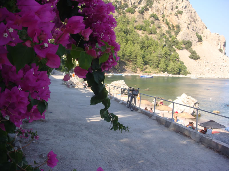
The waterfront

View the complete route in Google Maps:

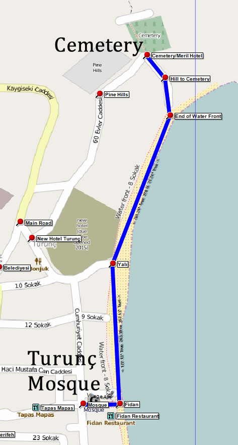
1 - Mosque to Cemetery (700m)

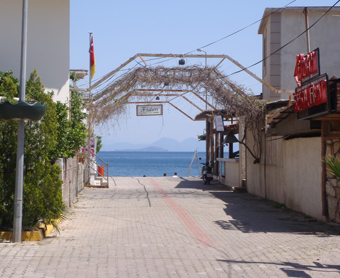
The walk starts at the village Mosque in the middle of Turunç and proceeds down to the water front by the side of Fidan's bar and restaurant.

On the water front turn left and stay on the water front with the sea on your right hand side until at the end the path turns left, away from the sea, towards the Meril Boutique Hotel. At the top of the rise you will see the Cemetery in front of you.

Section Image
Section 1 map
Section Image
Path to waterfront by Fidan

2 - Cemetery to Footbridge (1.3 km)

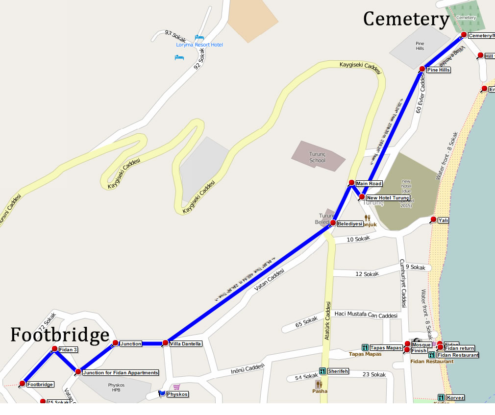
At the cemetery, turn left and follow the road up a gentle incline with Pine Hills apartments on your right. As the road levels off you will see Hotel Turunç Premium on your left. At the end of the road, turn right and head up to the main road out of the village. Here you turn left. Look out for the Turunç Beledyesi (Town Hall) on your right and keep right here into Catan Caddesi, rather than following the main road into the village. This road becomes something of a dirt track but is very gentle and on your left are some great views over the village. You can see how many green spaces still remain in the village.

As the track descends you will pass two roads on your left, and immediately after the second you should find Villa Dantella on your left. Continue straight on to the top of this road where you turn left. There is a road on your right where there is a café/restaurant a few metres up on the right should you need refreshment! As you pass a field on your left you may notice the back gate to Physkos Holiday Property Bond just to the side of the field.

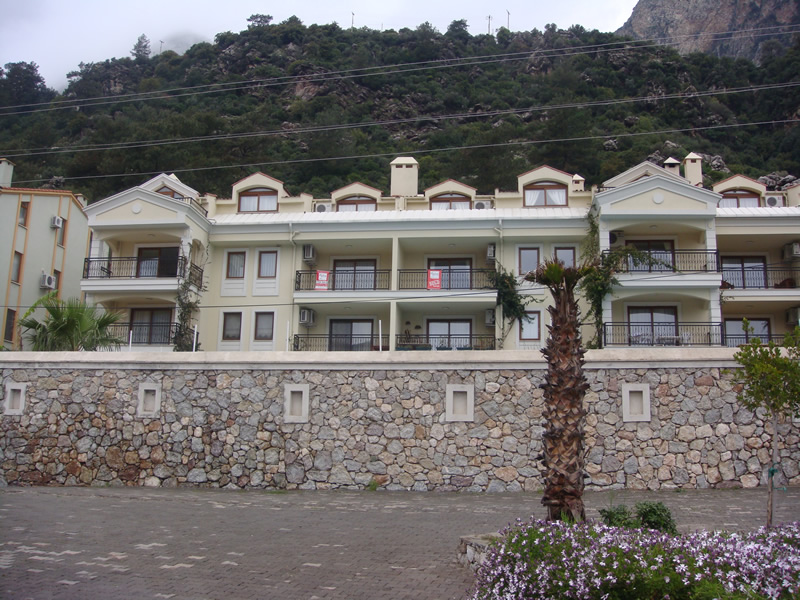
After a short distance you come to a road on your right. Turn right here and you will see the Fidan 3 apartment block in front of you.

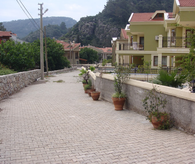
At the top, turn left, following the walls of the appartment blocks on your right. At the end, it appears to be a dead end, with a large Fig tree in the right hand corner. You have to skirt around the fig tree to find a small footbridge over the river bed.

Section Image
Section 2 overview map
Section Image
Heading up to Fidan appartments

3 - Footbridge to Vatan Caddesi Junction (1.5 km)

Cross the footbridge, noting the ancient Carob tree on your right, and turn left to follow the river bed on your left.

This is 75 Sokak and at the bottom, you turn right to rejoin Vatan Caddesi.

Continue on Vatan Caddesi, crossing over another river bed and a track on your left (that leads to the Turunç Monday Market site). The road becomes a dirt track and rises briefly before dropping down with some interesting views across the village on your left. You pass another road on your left then, after a further 250m, you will see a track ascending on your right. This is a short climb over a rough, ridged track but is well worth the effort.

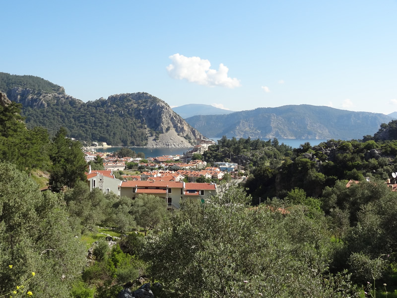
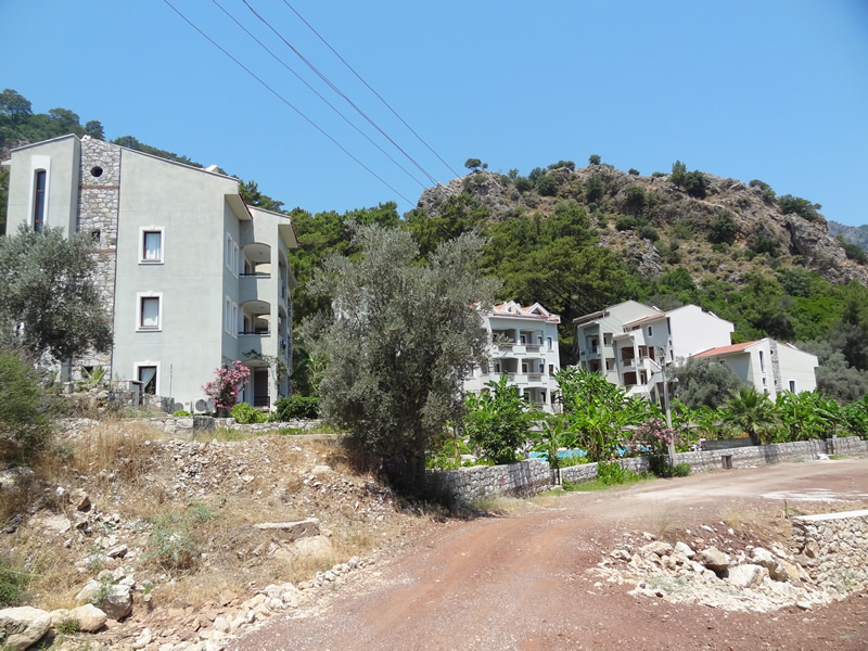
Turn right to join this track. If you prefer, just stay on the road until the end when you can pick up the route again at the Vatan Caddessi Junction way point. The track climbs over rough ground until you see the back of the Olive Grove appartment block on your left. At the top of the track, turn left. There is a track that continues straight ahead but you should keep left. Ahead you will see the intriguing Art Palace building and on your left are some of the most unusual views across the village and Turunç bay - definitely a photo opportunity!

The track then bends left and starts to descend. Some care is required here as the path is quite steep and there's lots of loose stone underfoot.

You will pass the front of the Olive Grove appartment block on your left. There is sometimes a bar to the side of the pool should further refreshments be required! Follow the road down to Gökçe Caddesi with Vatan Caddesi merging from your left.

Section Image
Section 3 Map
Section Image
75 Sokak

Section Image
View across Turunç

Section Image
Approaching the front of Olive Grove

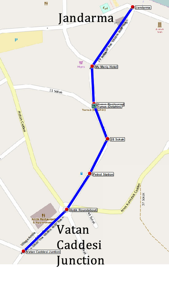
4 - Vatan Caddesi Junction to Jandarma (500 m)

Continue down Gökçe Caddesi passing a road on your left and the Antik Restaurant and Appartments, also on your left, to enter the Antik/Amos roundabout. Cross the roundabout, taking the second exit, 38 Sokak (the one before the Amos road - Amos Kumlubük Caddesi).


You will pass the petrol station on your left and, shortly after the road bends left, you should take the right hand fork at the Yunus (Dolphin) Restaurant. You may want to call in to Yunus and try one of their pide (Turkish pizza) or gozleme (Turkish pancake) cooked over an open wood oven. Continue to the right of Yunus and then keep right when the road forks at the My Meriç Hotel/Migros supermarket, taking you into 29 Sokak. This street leads directly to the harbour and, at the bottom, you will see the Jandarma (local Gendarmerie) station on your left.

Section Image
Section 4 Map
Section Image
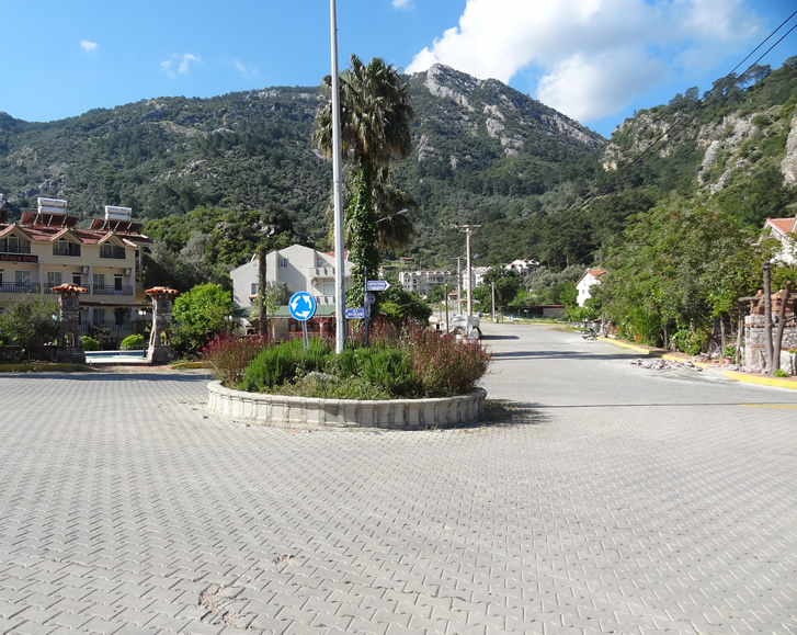
Looking back up Gökçe Caddesi from roundabout

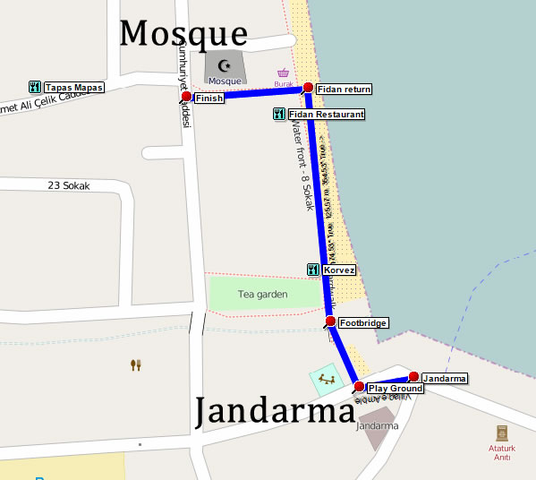
5 - Jandarma to Mosque (260 m)

From the Jandarma station, turn left on the harbour front and then turn right to cross the footbridge over the canal.

Follow the water front to pass Körfez Restaurant until you reach Fidan Restaurant where you turn left to reach the finish at the village Mosque.

Section Image
Section 5 Map

Feedback on Route 5 - Village Amble

No feedback has yet been received for this route. Please complete the feedback form to rate this route in terms of how much you enjoyed it.

You can help other walkers by telling them about the highlights, what you enjoyed most, and things to look out for.

Also, when you provide a rating you are helping others choose the most suitable walks.

Please provide us with your feedback/comments on this route so that other people can benefit from your experience. Your name and email address are optional. Your email address will never be displayed, but will allow us to respond if required. Your name, if provided, will be displayed along with your feedback. You can use your real name, initials, or a fictitious name.


1 2 3 4 5


CAPTCHA Image   Reload Image
Enter Code*:

quail-piping